
The History of Whitehall
The Whitehall area in the southern part of New Castle County, Delaware has a rich and varied history. The many navigable streams, rivers and bays nearby have shaped this history.
Tens of thousands of years ago glaciers receded up what is now the Delaware River and the Susquehanna/Chesapeake Bay estuaries, and a glacial moraine was left which formed the Delmarva Peninsula. The spine of that moraine is on the western side of Whitehall where the Summit Bridge and the Norfolk and Southern Railway line are located.
The peninsula had fertile, forested, flat land. From the 1600’s on, Dutch, English, and Swedish settlers obtained land grants from their respective kings or local appointed officials or later bought land to start farming. The many tidal streams and creeks flowing out to the Chesapeake and Delaware Bays made the area hospitable for native Americans because wildlife was abundant and hunting and fishing were rewarded. As settlers moved in and cleared the forests for farming the waterways greatly facilitated getting produce to profitable markets. But the waterways also made it easy for marauding pirates to attack towns and farms along the Delaware River. Up until 1704, New Castle, Kent and Sussex Counties were part of an English King’s (Charles II and his son the Duke of York) Pennsylvania land grant to William Penn. But in 1704 the citizens were tired of the pacifist attitudes of the Quaker administration and successfully petitioned to become a separate entity in order to raise militias to fight marauders.
The headwaters of the streams going east and west came close together in the Whitehall area, and as early as the 1600’s discussion was generated about building a canal to make a water passage across the peninsula possible. Benjamin Rush, and Benjamin Franklin discussed the idea seriously during the Revolutionary war. Five different routes were eventually considered. A lock canal was finally constructed connecting Delaware City on the Delaware River to Back Creek and the Elk River on the west and opened for business in1829. In the early years timber was one of the products most frequently shipped through the canal. Land around the Chesapeake Bay and on the Delmarva Peninsula was being cleared for farming and the lumber was needed for the growing communities along the east coast.
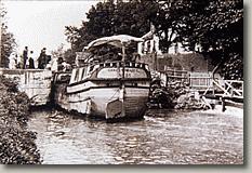
The original C & D Canal was a lock and dam system.
Traffic on the canal brought increased prosperity to the farms and towns along the canal (Delaware City, St. Georges, and Chesapeake City). The passengers and crews on the ships would stop for goods and services. During the Civil War the canal had strategic value because it was used as a way to get northern recruits south to campaigns in Virginia without antagonizing citizens by marching the soldiers through border states like Maryland and towns like Baltimore. In fact the Civil War period was probably the busiest and most profitable period for the early lock canal. In the late 1800’s there was even a park where Ratledge Road would have dead ended at the canal.
As the age of sail gave way to railroads and ever larger steamships, the canal owners competed by widening and deepening the canal. Traversing the 14 mile canal saved passengers and freight the extra three hundred miles required to go around the peninsula if going between ports on the Chesapeake and ports on the Delaware River. In addition it was an inland passage protected from rough, open ocean weather.
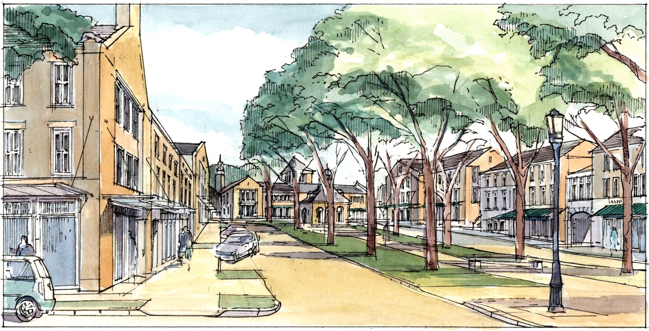
The planning model for Whitehall incorporates 1/4 mile walking radiuses for the residents.
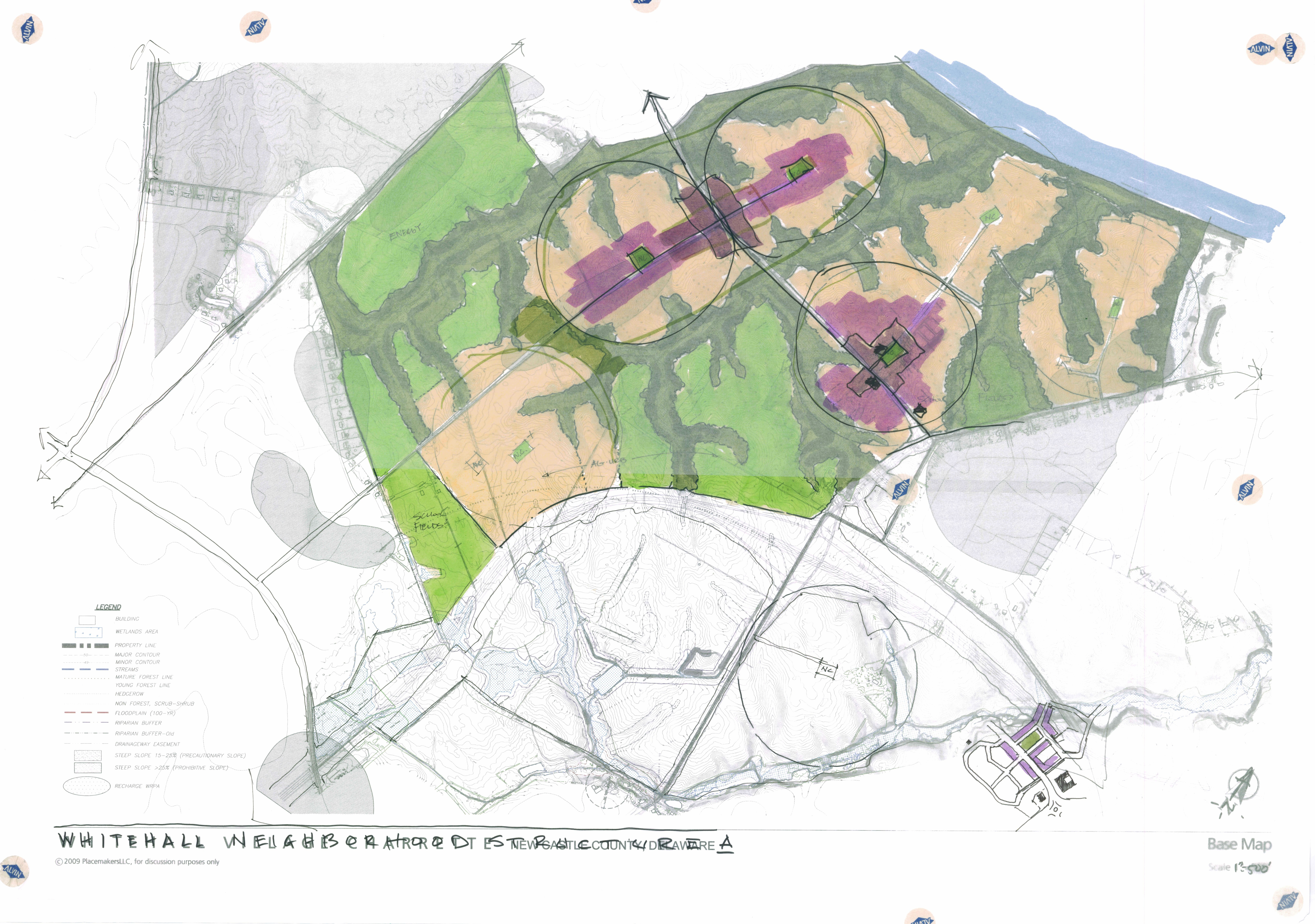
With advantageous shipping methods available and growing populations in cities like Trenton, Philadelphia, Wilmington, Baltimore and Washington, the Whitehall area turned from producing corn and wheat to growing highly perishable but valuable crops of peaches in the late 1800’s and early 1900’s. Substantial fortunes were made on peaches and some of the impressive homes built with this money can still be seen in southern New Castle County. Theodore Roosevelt recognized the strategic value of the canal as he was building up the US Navy and he appointed a commission in 1906 to study taking over the original canal company and making the lock canal into a wider, deeper, sea level canal. By the 1920’s the new straighter sea level canal built by the Army Corps of Engineers was opened with a guaranteed depth of 35 feet. It remains today one of the busiest canals in the western hemisphere (up to 20,000 commercial and pleasure boats traversing it each year), and the only one in the US in continuous service since the early 1800’s. The Whitehall property has a mile of frontage along the canal.
The new, sea level canal was great for shipping, but the towns and farms along the canal languished because the ship crews and passengers no longer got off at the locks to buy goods and services. At almost the same time, a blight infected the peach crops and by the 1940’s peach farming had moved to Georgia. New farmers from rapidly developing suburban areas around Philadelphia and New York City moved into southern New Castle County in the 1940’s and they turned to growing vegetables for local markets plus potatoes, corn, wheat and soybeans. In the middle decades of the 20th century, the Whitehall area was a quiet rural farming area, worlds apart from the populous and growing areas in northern New Castle County and the state capitol at Dover in Kent County. But, that rural condition would not last.

The property was originally slated for nuclear power, before the Welfare Foundation purchased it.
The growth in northern New Castle County and surrounding states increased the need for electric power and so beginning in the 1960’s Delmarva Power began to acquire land along the canal to build an atomic power plant. Just as the plant was about to be started, the Three Mile Island meltdown occurred (1979), nuclear power plant construction costs escalated and the Delaware Public Service Commission decided not to allow a nuclear plant to be built. Delmarva was required to sell the 2000 acre parcel they had accumulated. The Welfare Foundation Inc was the only buyer and purchased the parcel in 1984. Welfare thought that the land would be a good investment and eventually they could give some away and develop the remainder. The land was particularly well situated because it was bordered by roads on the west, south and east with the canal on the north.
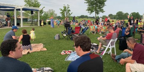
In 2003, the Foundation began a partnership with two Delaware companies who have nearly two centuries of development and construction experience in the community. Eastern States Development Company and EDiS Company, represented by the Julian and DiSabatino families, began a partnership with the Welfare Foundation. Together they would begin implementing the Foundation’s vision to improve the value of the property while leaving a legacy project that would dramatically improve the lifestyle of the residents and provide an inspiration for future development. They would ultimately choose a New Urbanist approach for the community development. This project would sit aside other related developments, including the Scott Run Business Park.
The first village town center is anchored by a civic building and flanked by living space above retail.
In the background of the development process, the partners recognized that local development continued at a strong pace in the 1990’s through 2008 in northern New Castle County and began to quicken south of the canal. Traffic going north and south in Delaware was increasing, particularly Delaware beach traffic and so a new interstate grade road, Delaware Route 1, was opened going from I-95 to Dover in 2004. It added capacity to relieve the overcrowded route 13 that T. Coleman duPont had built in the 1920’s with his own funds for the same purpose. Route 1 was quickly followed by a decision to construct a cross road going from 301 in Maryland to DE 1. The crossroad, when completed, would have an intersection on the Whitehall land. The intersection would be between the recently built St. Georges Vocational Technical High School and the recently approved 1.8 million sq. ft. Scott Run Business Park. The business park and the high school are both on Whitehall land on the east side of the property. In 2010, the planning process ended and engineering for The Town of Whitehall began.