
Making Cycling Work for Half a Million People in Delaware

Bike Delaware’s mission is to make cycling a safe, convenient and fun transportation option in Delaware. That’s their journey, but what direction are they going? That’s where the vision comes in. Bike Delaware’s vision is bikeway networks – connected routes that are designed for cycling. DelDot has hired Civil Engineering Professor Peter Furth (Northeastern University) as a consultant to help implement a new tool to help plan effective, safe, and well connected bikeway networks. Dr. Furth’s method is called “Level of Traffic Stress Analysis”
The basic idea behind Level of Traffic Stress analysis is that everyone has a particular tolerance for “traffic stress” – the physical and mental stress induced by automotive traffic. Think of it as a comfort zone for cycling around town.
If a particular trip contains a segment which is out of a cyclist’s comfort zone, he or she will find a less stressful detour. But if no reasonable low-stress detour exists, cyclists may choose to try to manage that trip segment by dismounting and walking, or riding on a sidewalk or even on grass. Most likely (if the option exists), he or she will simply not cycle at all and instead accomplish the trip via another mode.
Whenever a cyclist is unable to get from point A to point B within their comfort zone and without unreasonable detour that is a failure of infrastructure. Or, to make the same point in a more positive and optimistic way, that is an opportunity for improvement.
In Level of Traffic Stress (LTS) analysis, roads, streets and pathways are rated on a simple scale from 1 to 4. The LTS is determined by a few simple intuitive inputs that affect how people riding bikes typically interact with the street. Are there bike facilities present? If so, what kind? How wide are they? Do cyclists have to share the roadway with cars? What’s the speed limit? Are intersection crossings safe? These factors are then used to determine the LTS designations for route segments and intersections.
-
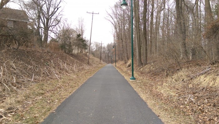
- LTS 1 – Very low stress – safe and comfortable enough for children, novice riders, and anyone willing to get on a bike. The Pommeroy Trail in Newark. It doesn’t get much easier than this. Click through to see examples of other LTS conditions.
-
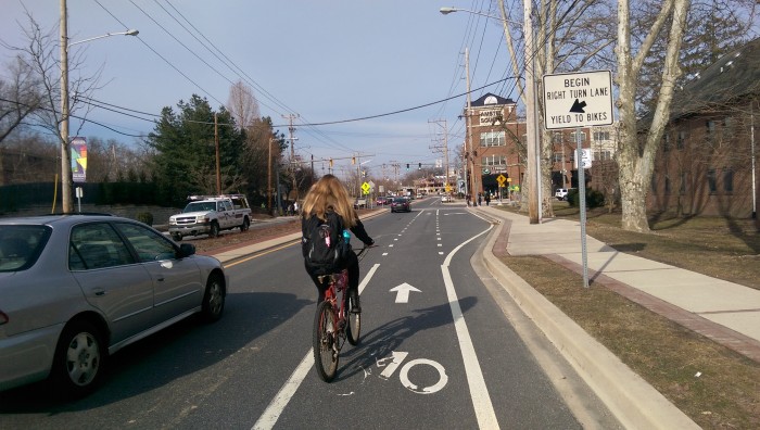
- LTS 2 – Based on Dutch bikeway design guidelines – Within the tolerance of the Interested but Concerned population. Elkton Road, Newark. Well-designed bike lanes with safe, easily understood intersection crossings.
-
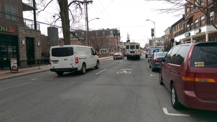
- LTS 3 – Within the tolerance of the Enthused and Confident population. Main Street, Newark. Requires more confidence and a tolerance for traffic stress but still, a relatively safe scenario for cycling.
-
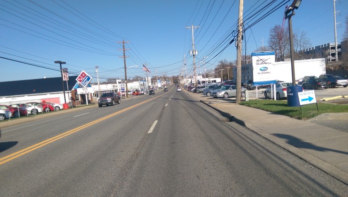
- LTS 4 – Down right scary – tolerated only by the Strong and Fearless types that aren’t intimidated by high speed, high volume traffic and auto-centric street design. Cleaveland Ave, Newark. The rest of us will probably find another way or just give up and walk the sidewalk.
To make cycling comfortable for the widest possible population, most cycling trips from beginning to end should be possible using low-stress streets or pathways (i.e.”LTS 1″ or “LTS 2″ routes). The collection of such existing routes is the low-stress bikeway network. Using LTS analysis, we can determine the size of the low-stress bikeway network, where it goes, estimate how many people have access to it, how many of their daily trips are feasible under low stress conditions and – most importantly – how the addition of new infrastructure would likely affect these numbers.
In Delaware’s 2014 Bicycle Friendly Report Card, the League of American Bicyclists’ #1 recommendation was to “Develop a capacity to analyze bicycle travel in terms of the percentage of trips that can be made under low traffic stress conditions” – exactly what LTS Analysis offers. When this tool is integrated into future planning efforts, DelDOT will gain profound new insight into how new pathway and roadway projects affect the area’s bikeability and relation to the existing bikeway network. And Bike Delaware will gain a needed quantitative tool that they can rely on to make the vision of bikeway networks – that everyone can use to get where they want to go – a reality.
This article, written by Paul Moser, was originally published at Bike Delaware, and has been shared with permission with The Town of Whitehall.